
After a long gap a short new addition to the website with stacked images of stars.

After a long gap a short new addition to the website with stacked images of stars.
A few weeks ago there were a few cold and almost cloudless nights. Using the same setup described previously I captured images with a Raspberry Pi and glued them together.
More pictures from 2019 are in this Google album.

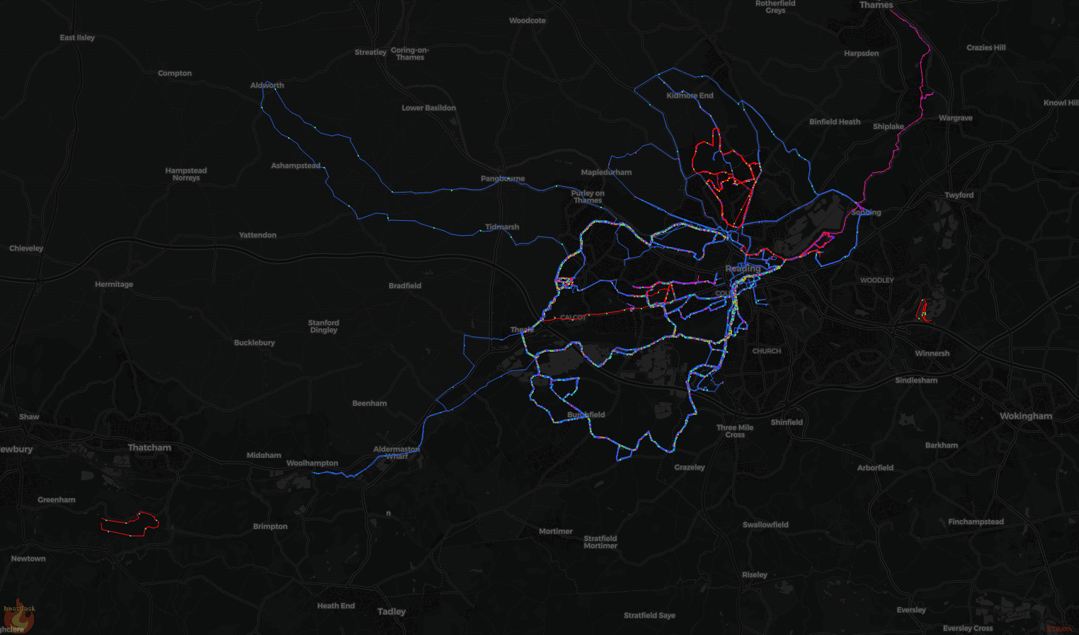
Using the excellent Heatflask you can visualize my cycling and running around Reading
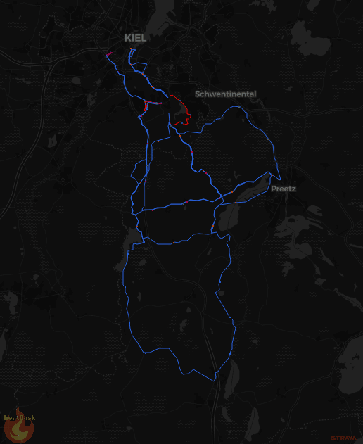
and Kiel
 .
.
Bike rides are blue and runs are red.
This August I managed to get a better picture of the Airbus Beluga in Hamburg
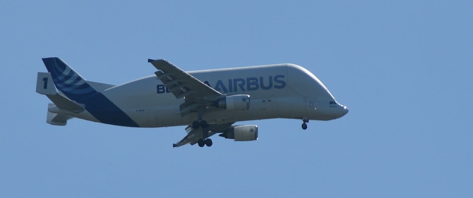 . This amazing plane looks about as airworthy as a bumblebee and unlikely to be able to fly.
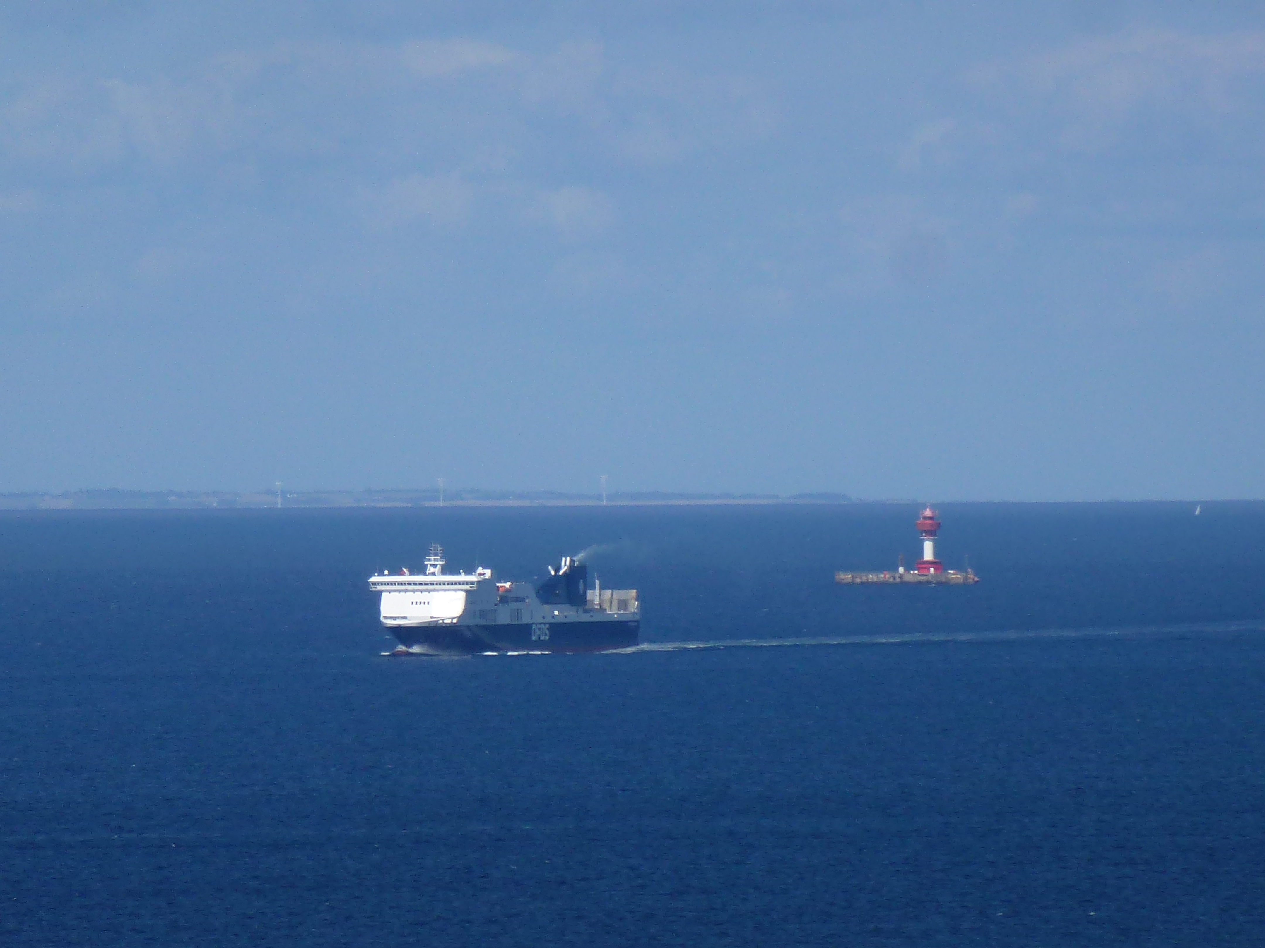
From the tower in Laboe I took a picture of the Kiel lighthouse with an approaching DFDS ferry.
And on the way we were treated to a nice sunset in Hoek van Holland onboard the Stena Britannica.
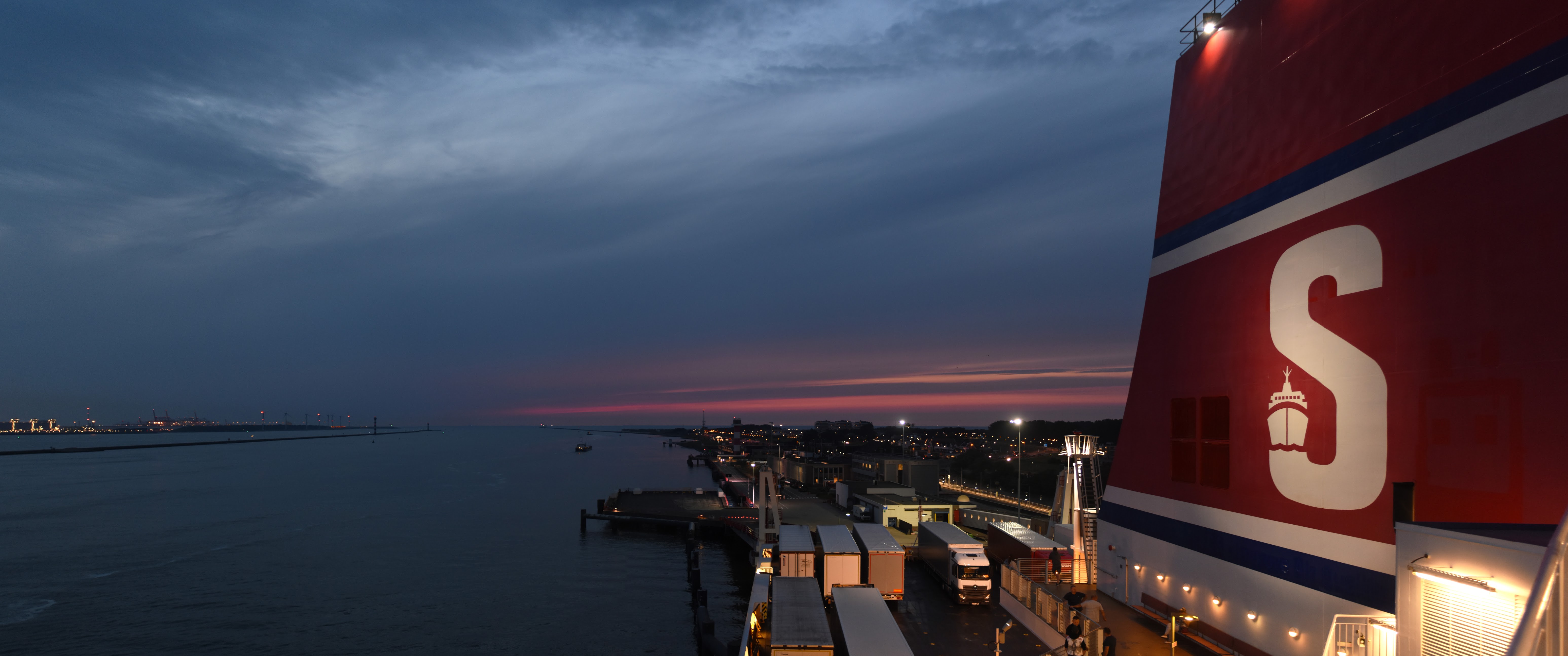
There are more picture in my Google Photo album.
I wrote this a a few years ago for my website that I have now migrated to wordpress.
Soon after Google Latitude started I signed up for it and sporadically updated my location. This worked slightly better with more advanced phones, but until I got my hands on a Nexus S in Autumn 2010 this always stayed very patchy. Just before Christmas 2012 a friend pointed me to Google Takeout that allows to download all data Goggle has stored about you including the Latitude data, if you have signed up for it. I had previously wondered how I could display my annual travel and had dabbled with the possibility to download parts of my entire in kml format form within Latitude. This however looked like it would make the whole project much simpler. So, I downloaded my data and thought I would quickly make a little map.
The first disappointment was that the takeout data was in json format and looking at it was not easy … After searching around for a while I found this script that converted json to kml. At last I could see my track in Google Earth. Unfortunately, Latitude includes quite a bit of erroneous data. So, the next step was to find a program that allows to edit a gpx trace. Again, it took a while to find the right program that I liked, eventually I found gpsprune . Now, the problem was that the entire annual data was a bit large. I used gpsbabel to break down the data into days.
#!/bin/bash

FirstDay=2011-12-24
for day in `seq 0 366`
do

begindate=`date -d "$FirstDay +$(( ${day} ))days" +%Y%m%d`00
enddate=`date -d "$FirstDay +$(( ${day} +1 ))days" +%Y%m%d`00

echo "$day $begindate $enddate"

gpsbabel -t -i gpx -f ../latitude-ordered.gpx -x transform,trk=wpt,del  -x track,split,start=$begindate,stop=$enddate -o gpx -F ../split/$begindate.gpx

done
Finally, I could go through every day and delete points that were wrong. I soon noticed that Latitude keeps reporting the same wrong data. So, another was used to scrub out those points.
#!/bin/bash
GPSBABEL=/usr/local/bin/gpsbabel
file=$1


LAT=12.345
LON=6.7890

LAT0=1.2345
LON0=67.8901

$GPSBABEL -i gpx -f $file  -x transform,wpt=trk,del  -x radius,distance=0.2K,lat=$LAT,lon=$LON,nosort,exclude -x radius,distance=0.2K,lat=$LAT0,lon=$LON0,nosort,exclude   -x transform,trk=wpt,del  -o gpx -F tmp.gpx

rm $file
mv tmp.gpx $file

exit
A few days (or weeks) later I had cleaned the entire data set and glued the traces back together with gpsbabel.
#!/bin/bash

touch join.gpx
# actually this needs to be file that has valid GPX but no points
# in it. Otherwise gpsbabel throws a wobbly. I simply copied the
# first gpx file and then deleted all track points.

for file in *.gpx
do

echo $file
gpsbabel -t -i gpx -f $file -i gpx -f join.gpx   -x track,merge,title="2012" -o gpx -F join-tmp.gpx
mv join-tmp.gpx join.gpx

done
exit
I could finally look at the result in Google Earth. It is a good idea to reduce the number of points a little bit which is easily achieved with gpsbabel.
#!/bin/bash
GPSBABEL=/usr/local/bin/gpsbabel

$GPSBABEL -i gpx -f $1 -x transform,wpt=trk,del -x transform,trk=wpt,del    -x simplify,count=7500 -x transform,trk=wpt,del -o kml,lines=1,points=1,line_width=4,trackdirection=1,labels=1 -F simple.kml
$GPSBABEL -i gpx -f $1 -x transform,wpt=trk,del -x transform,trk=wpt,del   -x simplify,count=7500 -o gpx -F simple.gpx

exit
The final product still has a few glitches which are mainly due to me being a bit slow to switch on data roaming or because Latitude failed (I believe there are a few days in 2012 where this was the case for my account).

I have finally found some time to use my Raspberry Pi as timelapse camera to capture some startrails. I found this useful page showing all the details needed to set the Pi camera to a maximum of 6s exposure. I got the best results by setting the shared video memory to the maximum setting of 256Mb. Otherwise the image numbers would have gaps.

Startrails taken with a Raspberry Pi
Now, I just need to repeat this next time there is good weather and new moon. Preferably I’m going to do this in a slightly darker spot with less light pollution.
I pointed /etc/rc.local to this srcipt (adapted from the above mentioned website)
#!/bin/bash
sleep 120
cd /home/pi/starttrails
raspistill -bm -tl 0 -v -set -ISO 800 -awb off -awbg 1,1 -t 14400000 -ss 6000000 -o %06d.jpg
shutdown -hP now
exit
The pictures were assembled with the following lines:
#!/bin/bash
# trail.jpg is a copy of the first immage 000000.jpg
for f in 0*.jpg
do
   echo $f
   convert trail.jpg $f -gravity center -compose lighten -composite -format jpg trail.jpg
done
exit
I have also turned the stills into a short timelapse video:
~/bin/ffmpeg-3.1.4-64bit-static/ffmpeg -r 15 -i %6d.jpg -vcodec libx264 trail.mp4
I finally got round to writing up the analysis of the energy consumption of our home. Using almost 2 years worth of consumption and temperature readings I work out the leakage of our house and look at the seasonality of our electricity consumption.
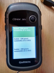
This is more a memo to self than a blog post. For an up to date map for the Garmin eTrex 30 go to Garmin Openstreetmap and download the required map. Then copy the file on to the SD card into a top level folder called Garmin, my Great Britain map has the filename gmapsupp_GB.img for instance. And that’s it, the map can now be enabled from the appropriate map menu. Routing works, but takes interesting turns for longer distances.
Similarly, tracks go into the Garmin/gpx. The can be selected as routes from the menu. The file Barry_s_Bristol_Ball_Buster.gpx gets displayed as Barry's Bristol Ball Bust for selection.
Last weekend we had potato pancakes to use up our surplus potatoes from Christmas. They were particularly yummy with German bacon and apple sauce from the our own garden.
 |
| From 2016 |
It is a simple recipe to make potato pancakes:
Simply fry the mixture until golden brown and it’s done. They taste nice with apple sauce or any other sweet thing, like honey, jam or chocolate spread.
The cold weather earlier this weekend produced a stunning sunrise on Wednesday morning. Below is a picture I took from the Thames path in Reading.
 |
| From 2016 |
For a while I had been contemplating replacing my 2008 Macbook (4,1) as it was stuck on OSX 10.6. But I couldn’t find any new affordable laptop that took my fancy (too expensive, too big, too small, just not right). I remembered reading about running Linux on MacBooks a while ago and thought, why don’t I try Linux?
I downloaded the 17.1 Linux Mint iso (cinnamon flavour) and followed the instructions to make a bootable USB stick.
I took out the internal hard disk and replaced it with an old one I had kicking about. After that, I plugged in the USB stick rebooted the MacBook holding down the ALT key and the machine booted into Linux after choosing the correct device (in the second attempt). I followed instructions that I largely ignored as they were not applicable. To get the WIFI working this line
apt-get install firmware-b43-installer
sufficed. And another irritation is that the touchpad doesn’t quite work but the interwebs have solutions for that as well. Though the relevant config file appears to live in
/usr/share/X11/xorg.conf.d/50-synaptics.conf
You can experiment with the settings using synclient.
I also added
coretemp
 applesmc
to
/etc/modules
And it’s a good idea to switch off hardware acceleration in Chrome as the screen goes black when watching youtube videos otherwise.
After a weekend of testing, I splashed out on a 1Tb SSD and put that in the MacBook and now have a fairly zippy 4Gb MacBook running a modern OS. Even Google’s tensorflow installed without a hitch.
